

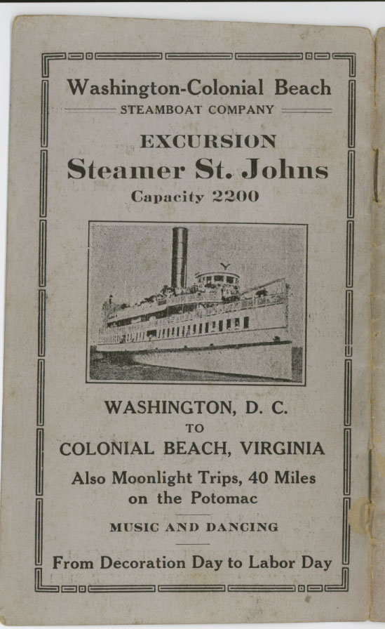
In 1922 the Majestic Steamship would ferry passengers between Washington D.C. and the resort town of Colonial Beach, Virginia, passing Alexandria, Virginia en route. This tour booklet was designed to be read along the journey.
I have done a very rough one-pass transcription below to begin to electronically unlock the content. It's a fascinating read, and it's interesting to see how "history" changes over time.
On a personal note, you'll see the name Huntley F. Casey stamped on the front of this booklet. He gave me this booklet when I was a kid among other things. He is one of the reasons I started OurHistoryMuseum.
Our connection was an unusual one. Mr. Casey was the original 1950s era occupant of the house I grew up in during the 1970s and 1980s at 8107 E. Boulevard Dr. in Alexandria. He and I corresponded over the years when I was just a kid. He would send me things like this booklet. I still treasure a small box that he sent with a letter inside that he told me was always in "my house" while he lived there. Today, it sits on the mantle in my parlour room.
Never underestimate the importance of planting a seed. You never know what it might grow into. I think Mr. Casey would be proud.
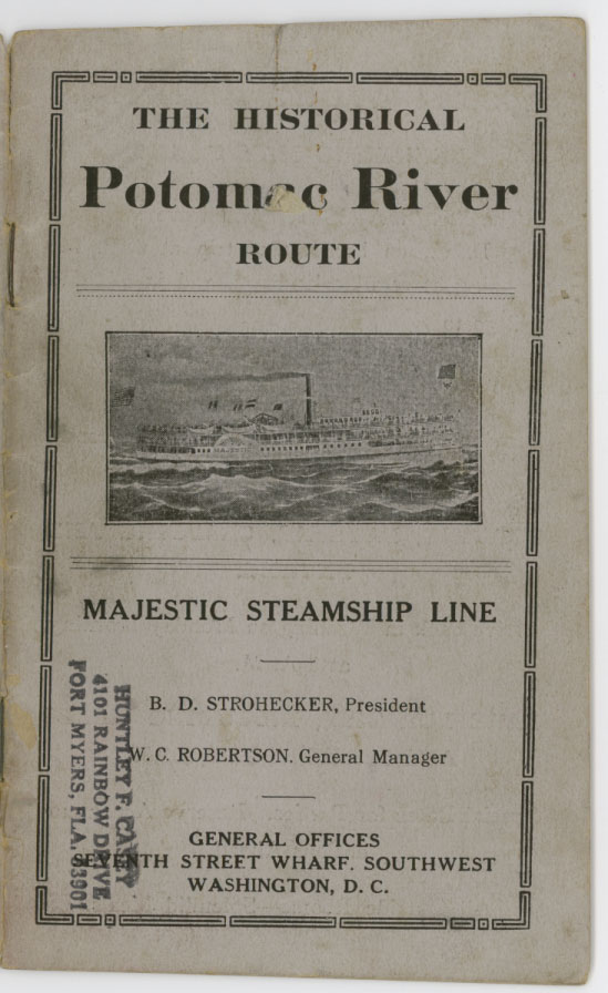
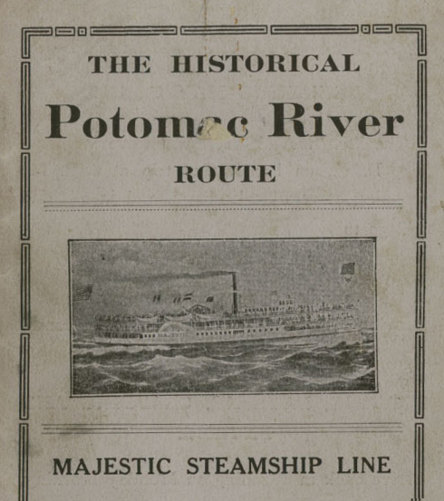
The Historical Potomac River route
Majestic steamship line
BD Stronach Herb, president
WC Robertson, general manager
General offices
Seventh Street wharf, Southwest
Washington DC
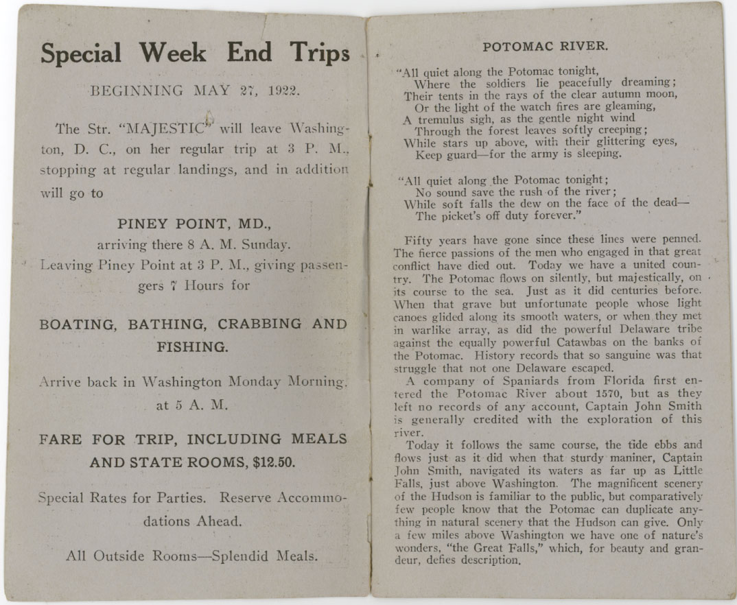
Special weekspecial week and trips
Beginning May 27, 1922
The STR “majestic “will leave Washington DC on her regular trip at 3 PM stopping at regular landings, and in addition will go to
Piney point Maryland
Arriving there 8 AM Sunday
Leaving Piney point 3 p.m., giving passengers seven hours for
Boating,Boating, bathing, crabbing and fishing
Arrive back in Washington Monday morning at 5 AM
Fair for trip, including meals and state rooms, $12.50
Special rates for parties. Reserve accommodations ahead.
All outside rooms – – splendid meals.
Potomac River
“
“All quiet along the Potomac tonight,
Where the soldiers like peacefully dreaming;
Their tents in the rays of clear autumn moon,
Or the light of the watchfires are gleaming, a tremulous sigh, as the gentle night wind
Through the forest leaves Saufley creeping;
Well stars up above, with her glittering eyes,
Keep guard – – for the army is sleeping.
All quiet the Potomac tonight;
No sound save the rush of the river;
All softballs to do on the face of the dead--
The pickets off duty forever. “
50 years have gone since those lines were pinned. The fierce passions of the men who engaged in that great conflict have died out. Today we have a united country. The Potomac flows on silently, but majestically, and its course to the sea. Just exited centuries before. When that grave but unfortunate people whose light canoes glided it along it’s smooth waters, or when they met in war like a ray, as did the powerful Delaware tribe again see equally powerful Catawbas on the banks of the Potomac. History records that so sanguine was the struggle that not one Delaware escaped.
A company of Spaniards from Florida first entered the Potomac River about 1570, but as they net left no records of any account, Captain John Smith is generally credited with the exploration of this river.
Today it follows the same course, the tide abs and flows just as it did when that sturdy mariner, Captain John Smith, navigator that’s Waters as far up as Little Falls, just above Washington. The magnificent scenery of the Hudson is familiar to the public but comparatively few people know that the Potomac can duplicate anything in natural scenery that the Hudson can give. Only a few miles above Washington we have one of natures great wonders, the Great Falls, Which, for beauty and grandeur, defies description.
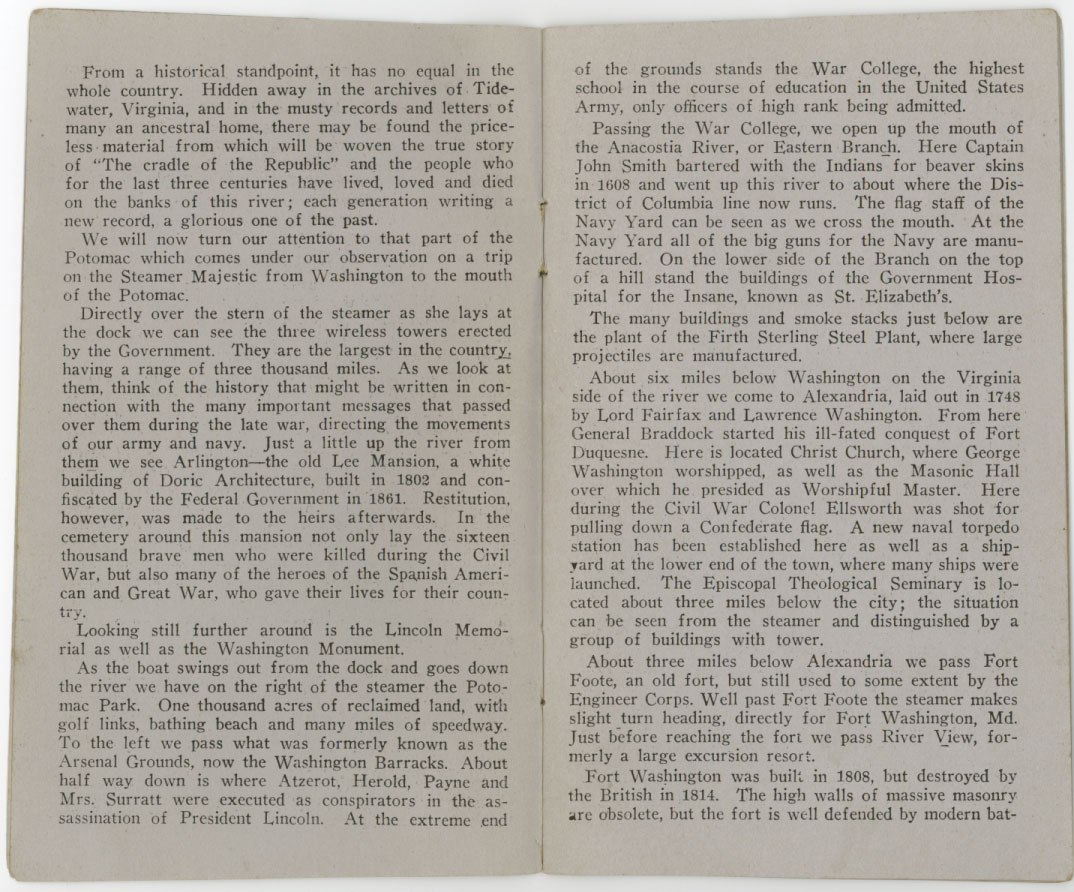
From a historical standpoint, it has no equal in the whole country. Hidden away in the archives of Tidewater, Virginia, and in the musty records and letters of mini Indiana test or a home, there may be found the priceless material from which will be woven the true story of “the cradle of the Republic quote and the people who for the last three centuries have lived, loved and died on the banks of this river; each generation writing a new record, a glorious one of the past.
We will now turn our attention to that part of the Potomac which comes under our observation on a trip on the steamer majestic from Washington to the mouth of the Potomac.
Directly over the stern of the steamer as she lays out at the dock we can see the three wireless towers erected by the government. They are the largest in the country., Having a range of 3000 miles. As we look at them, think of the history that might be written in connection with the many important messages in the past over them during the late war, directing the movements of our army and navy. Just a little up the river from them we see Arlington – – the old Lee mansion, a white building of dark architecture, built in 1802 and confiscated by the government in 1861. Restitution, however, was made to the errors afterwards. In the cemetery around the mansion not only lay the 16,000 brave men who were killed during the Civil War, but also many of the heroes of the Spanish American and Greek war, who gave their lives for the country.
Looking still further around is the Lincoln Memorial as well as the Washington monument.
As the boat swings up from the dock and goes down the river we have on the right side of the steamer the Potomac park. 1000 acres of reclaimed land, with golf links, bathing beach and many miles of speedway. To the left we pass what was formally known as arsenal grounds, now Washington barracks. About halfway down is where at Sarot, Harold, pain, and Mrs. Sarot were executed as conspirators in the assassination of President Lincoln. At the extreme end of the grounds stands for war College, the highest school in the course of education in the United States Army, only officers of high rank being admitted.
Passing the war College, we open up the mouth of the Anacostia River, or eastern branch. Your captain John Smith bartered with the Indians for beaver skins in 1608 and went up this river to about where the district of Columbia line now runs. The Flagstaff of the Navy Yard can be seen as we cross the mouth. At the Navy Yard all of the big guns for the Navy are manufactured. On the lower side of the branch on top of a hill stay in the buildings of the government hospital for the insane, known as Saint Elizabeth’s.
The mini buildings in smokestacks just below are the plant of the Firth sterling steel plant, we are large projectiles are manufactured.
About 6 miles below Washington on the Virginia side of the river we come to Alexandria, laid out and 1748 by Lorde Fairfax and Lawrence Washington. From Hill General Braddock started his ill-fated conquest of Ford Duquesne. Here is Located Christ church, we are George Washington worshiped, as well as the Masonic Hall over which he presided as worshipful master. Here during the Civil War Colonel Ellsworth was shot for pulling down a confederate flag. A new naval torpedo station has been established here as well as a shipyard in the lower end of town, where many ships were being launched. The episcopal theological seminary is located about 3 miles below the city; the situation can be seen from the steamer in distinguish by a group of buildings with tower.
About 3 miles below Alexandria we passed Fort foot, an old Ford, but still used to some extent by the engineer core. Well past forefoot the steamer makes a slight turn heading, directly for Fort Washington, Maryland. Just for for reaching the fort we pass Riverview, formally a large excursion resort.
Fort Washington was built in 1808, but destroyed by the British in 1814. The high walls of massive masonry are obsolete, but the fort is well defended by modern batteries. Just a little below Fort Washington, on the opposite side of the river, stands Fort Hunt. This Fort walnut of an imposing nature, is also well defended.
Just below the hill at Fort Washington we see the mouth of Piscataway creek. In the mouth of this Creek Leonard Calvert anchored his ship “dove quote and held conference with the Indians as to establishing a Conolly colony, but decided it was too far from the mouth of the river and returned to Saint Mary’s.
On the lower side of the creek buildings of the United States fishery commission can be seen. These buildings are used for the propagation of different kinds of fish.
Passing the Fish commission buildings at Brian‘s point, we open to view the lands of the estate of Mount Vernon. What about halfway down this “reach “the home in tomb of Washington can be plainly seen. The house is easily recognized on the hill by its white columns. It was built in 1743 by Lawrence Washington, and bequeath to George Washington in 1759.
A couple of miles below Mount Vernon, on the River, stands Marshall Hoel, now an excursion place but formally the home of the marshals, who are connected with the renowned chief justice of that name.
As we pass Marshall Hoel, just a head of the boat we see a high Bluff, well damn near the shore as we get closer we can distinguish a small White House; this house is built on the side of Belvar a mansion, which was the home of Lord Fairfax, who owned not only the Northern neck of Virginia, But as far back as the mountains. It was through him young George Washington got his start, well surveying the lines of his property back in the mountains and valley of Virginia which was then and almost untrodden wilderness. Rounding the point at the White House we end up a small wharf built by the US engineers for their convenience at camp Humphreys, used as an engineers camp during the late war – – just a short distance from this wharf.
This wharf is at the mouth of Pohick creek, At the head of which is the church by that name for Washington worshiped in his early youth.
On a slight elevation below the mouth of the creek stands Gunston hall, on the top of which a red brick building can be seen. Gunston Hall was built by George Mason in 1758. He was the author of the Virginia Bill of Rights, and one of the framers of our constitution.
Shortly after passing Dunstan haul the boat makes another bend around Halloween point, which opens up to view Glowmont, a small wharf on the Marilyn side, and Indianhead. Legend says that from Hollaran point the Indian heard, from which comes the name Halloween point and Indianhead. Passing around Indianhead we see the naval proving ground wharf. At this station until very recently, all of the big guns for our ships were tested. But the but as the range became greater another station has been located farther down the river for the largest guns. There is also a smokeless powder factory located below the proving grounds, the smokestack of which can be seen in the distance.
After passing the naval proving grounds, the river becomes much wider; to the right we cross the mouth of Occoquan bay, at the head of which is the work house for the district of Columbia. The Spaniards who came up the Potomac in 1570 are supposed to of come up this far.
Below Occoquan can be seen the mouth of a small creek – – near Absco. On the hillside at the mouth of this creek was found in 1837 the oldest monumental inscription in the United States. It probably marked the grave of one of John Smith followers. It reads: “here lies the body of Lieutenant William Harris, who died may E 16 in 1608, Aged 65 years. By birth of Britain, a good soldier, a good husband and neighbor. “
Turning attention again to the Maryland side of the river, we soon pass stump neck, where the Marine Corps established a rifle range and where many of the sharpshooters of that branch of the service were trained, from the large marine camp was established at Quantico a few miles below on the Virginia side of the river.
Near Quantico, at cockpit point, the confederate battery was shelled by union gun boats on January 2, 1862. After passing Quantico we pass in succession on the Maryland side Sandy Point, Liverpool wharf and dense wharf, formerly Clifton beach, used about 30 years ago as an excursion place. About opposite from Clifton Beach is wide water, a station on the Richmond, Fredericksburg and and Potomac railway, running from Washington to Richmond. Off-white water was a favorite place for president Cleveland to go duck shooting. It was also hear that Professor Langley made his experience experiments with a flying machine, and where, as a matter of fact, the first heavier than air machine ever flew. He had his machine started from the top of a large arc anchored in the river, obtaining its momentum from heavy springs at the end of the track lead for the machine. His model flew 1000 feet in 1 1/2 minutes, on May 6, 1896. Experience experiments made here by Langley have proved invaluable to aerial navigation.
A few miles below wide water we see the mouth of a quiet creek. Paren 41 miles from Washington.) tradition locates the fabulous silver graphite mines of the Indians at the head of this creek. Prior to the Civil War, before the railroad can connection was completed between north and south, it was the at the mouth of this creek where old male boats landed their passengers from Washington and the north. During the war it was used exclusively as a landing for men and material in the same way.
Again we have a sharp bend in the river; in fact, part of the way in this “reach” we are steering nearly north east and still going down the river. In entering this reach we passed the first lighthouse since passing Fort Washington – – Maryland point lighthouse. Or the lighthouse stands well over on the Virginia side, Maryland point proper is on the officer inside of the channel. Under this point Gordon anchored the British fleet while the buildings in Washington were destroyed.
On the Marilyn side we now pass Nanjemoy stores or Riverside, as it is now called, while just below that place we see another lighthouse-upper Cedar point – 51 miles from Washington. After passing the light is the mouth of Port tobacco creek, named after him Indian queen, one of the converts of father White, in 1635. There is still a large amount of tobacco raised in this section of the river. On the hill at the lower Side of the creek can be seen Saint Thomas Catholic Church, while a little distance up the creek is Chapel point wharf. The Catholic Church through Lord Calvert had many grants of land on the Marilyn side, some of which in this vicinity are still in existence.
We are now nearing Matthias point light which we pass on the starboard side. At Matthias point during the Civil War the first confederate batteries were established with guns from the Norfolk Navy Yard. It was here the captain Ward, of the Gun boat resolute was shot.
Passing Matthias point light and hauling down the river, we are within a few miles of popes creek, the terminal of the Baltimore and Potomac railroad. From Pope’s Creek there is a small boat that transports male to colonial Beach on arrival of trains. Just above the mouth of the creek a small White House may be distinguished on the hill; it was on the side of this house where Dr. mud set the broken leg of Booth in his attempted escape after the assassination of Lincoln. Booth crossed the river close to this point. Ludlow‘s theory is a short distance below pops Creek; across here all kinds of contraband articles were ferried during the Civil War.
Just below here we pass lower Cedar point lighthouse 61 miles from Washington. While we passed the light on the starboard side Cedar point proper is on the Marilyn side and was formally used as an excursion place patronized by both Baltimore patronize both by the people of both Baltimore and Washington.
About halfway between Cedar point and colonial Beach, which now looms up in the distance can be seen the mouth of mock Aldock Creek, back of which has been established the new naval proving ground, For testing the largest guns. New paragraph
Colonial Beach is the largest and most popular summer resort on the Potomac. In winter in the winter used extensively for oystering purposes, many good oysters being dredged off kettle bottom Shoals abreast of the beach where the old hotel stands, And in fact part of the same was the home of general light horse Harry Lee.
Just below colonial Beach is the mouth of Monroe Bay, named after President Monroe who is born a short distance from the head of the day.
A few miles below we passed the spot where George Washington was born – Wakefield. Nothing of the old house remains, having been destroyed before the revolution the spot is marked by a monument with the inscription: “here on 11 February 1732, George Washington was born. “
At one time there was a war were small draft boats could land. This is gone and can only be reached by Land.
Not far from Wakefield is Stratford, the ancestral home of the leas. This house was built by Thomas Lee, of old English brick, in 1730. The queen of England is said to have supplied the funds to rebuild the house after his head burned. It is still in good preservation.
Below we see nominee cliffs, we are large beds of ocean moral, in which all kinds of prehistoric bones, shells, etc., can be found.
We are now abreast of Blackistone Island, on the Marilyn side. It was on this island the party from the ship “dove “held the first religious service in Maryland, and directed across.
Back of the island are Saint Clements and Breton bees. At the head of one of those is Leonardtown, named after Benedict Leonard Calvert, the fourth Lord Baltimore. The estate of Francis Scott key is not far from Leonard town and is still held by his descendants.
We now enter nominee Creek, described by Captain John Smith in his voyage of the Potomac in 1608. He states it for about 30 miles after entering the Potomac no sign of life had been seen, but they had hardly entered “a little bead creek ““towards onawamanient (nomini) when we found all the woods roundabout lead with ambushes to the number of three or 4000 savages, so strangely painted, ground, and disguised, shouting, yelling and crying as so many spirits from hell could not have showed more terrible. “
Inside of nominee Creek there is Beall‘s wharf, Maguires wharf, deep point, and nominee.
Proceeding from nominee Creek down the Potomac we passed ragged point lighthouse, on the Virginia side, while on the Marilyn side, just a little below, is Piney point, where there is a hotel and summer excursion place.
About 10 miles from Piney point, across the river, which is now 6 miles wide, we can see the mouth of the Jo, Cole River, at the head of which is Kinsale, said you have been laid out for a city at the same time as Philadelphia. A few miles back from Kinsale is the Yeocomico Church, One of the oldest churches in the United States. It was in this church where Washington was baptized, the original found still being used in the church in good preservation.
On June 14, 1813, the mouth of the year, cold was the scene of one of the most sanguine encounters in the war of 1812. The US “Aspe, “in the command of midshipmen Sigourney, was attacked by the British “contest ““ Mohock. “The gallant crew of the “Aspe “were wiped out of existence, having been out numbered 5 to 1.
You are now looking out on Chesapeake Bay. Point look up may be seen from the city steamer. At point Lookout there is a granite monument directed by the US government in memory of the 3800 Confederate soldiers who died in federal prison there. WCRObtaining its momentumHello Occoquan can be seen the mouth of a small creek – –Hello Occoquan can be seen the mouth of a small creekHello Occoquan can beHas been locatedHollaran point the Indian heardHollaran point
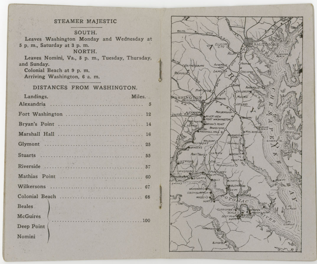
Steamer majestic
South. Leaves Washington Monday and Wednesday at 5 PM, Saturday at 3 PM
North
Leaves and how many, Virginia, 5 PM Tuesday, Thursday and Sunday.
Colonial Beach at 9 PM
Arriving Washington, 6 AM
Distances from Washington Alexandria 5 miles Fort Washington 12 miles Bryans .14 miles Marshall Hall 16 miles Glenmont 25 miles Stewart’s 55 miles Riverside 57 miles Mathias .60 miles Wilkerson‘s 67 miles colonial Beach 68 miles Bealls Maguires the point nominee 100 miles

Leave Comment